The Tech-Levee-Watch project involves the implementation of a series of interconnected activities in order to obtain a diagnosis-monitoring-alert procedure and to provide a methodology to prevent and contain the hydrogeological risk associated with earthen levees.
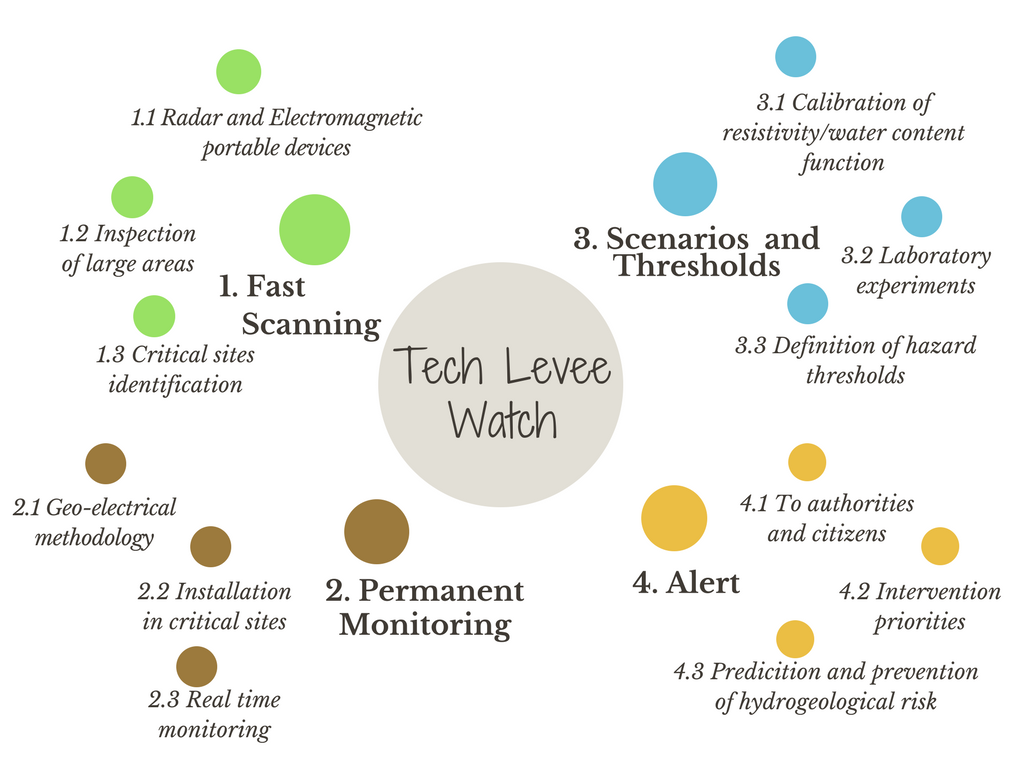
- Fast Scanning: The starting phase of the procedure involves a fast analysis of the study area using portable GPR and electromagnetic devices. This process allows a fast detection of levees’ segments that have a risk of failure due to holes or localized seepage. This system provides a map of the area, showing which zones have to be further analysed.
- Permanent monitoring: After having localized high risk sites, because of the possible instability or because of the high exposure of the surrounding zone, the permanent installation of a geo-electrical system is implemented. The prototypal device has buried cables and electrodes and a command box which starts, saves and sends the measurements through internet connection. The frequency of the measurements is settable and allows to monitor the situation in real time. A meteorological station is also installed to monitor weather parameters.
- Scenarios and thresholds: Thanks to geo-electrical monitoring, water content in the embankment can be measured, calibrating a resistivity/water content function. In this way lack of homogeneity in seepage or fast changings in the situation can be detected. Doing laboratory experiments and simulating seepage through the levee, scenarios of water content and scenarios of levee breach can be related and thresholds of collapse can be decided.
- Alert: The system provides an assessment of the vulnerability of the earthen levee in real time, giving the chance of deciding a priority of intervention and helping the managing authorities during extreme events. The alert procedure is the final and most important one, because provides to citizens and authorities an alarm related to current situation at the critical site.